Effective vegetation management for utility companies is essential to preventing power outages, reducing wildfire risks, and meeting strict regulatory requirements. The staggering financial toll of the January 2025 Los Angeles wildfires is projected to reach up to $164 billion in property and capital losses. For utility companies, these numbers translate to higher liability exposure, rising insurance costs, and increasing regulatory scrutiny. With wildfires intensifying each year, utilities can no longer rely on reactive vegetation management. They need proactive, data-driven strategies that provide real-time insights and improve field efficiency.
These costs don’t just affect infrastructure—they hit the communities we live and work in. With growing pressure to manage overgrown trees and shrubs near power lines, utility providers must adopt smarter, data-driven vegetation management strategies to ensure grid reliability and public safety.
As wildfire threats and regulatory pressures intensify, vegetation management for utility companies has become a top priority to prevent outages, maintain compliance, and reduce financial risk. Many are now investing in advanced vegetation management technologies, using real-time data and predictive analytics to identify hazards before they escalate, minimize disruptions, and improve overall grid reliability.
Overcoming the Challenges of Using Multiple Apps in Vegetation Management for Utility Companies
Managing vegetation near power lines with multiple mobile applications can be cumbersome and inefficient. Many utility companies still rely on disconnected apps for mapping, reporting, and task management. This fragmented approach creates data silos, slows response times, and increases compliance risks—all of which can lead to costly service disruptions.
For organizations using Salesforce, the challenge is even greater. Without a unified vegetation management system for utilities, teams struggle to maintain a comprehensive, real-time view of vegetation-related risks. For example, a crew might inspect a site and flag a hazard, but if that data isn’t immediately accessible across teams, scheduling and compliance documentation can be delayed—creating unnecessary risk. This fragmentation can slow response times and increase the likelihood of compliance issues or service disruptions.
Real-World Use Cases: Enhancing Efficiency and Safety
Utility Company A: Streamlined Field Reporting & Compliance
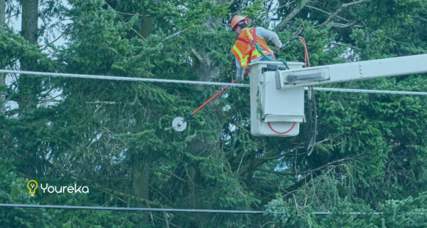
One utility company leveraged Youreka to get the most out of their Salesforce and mobile experience to manage vegetation projects. With Youreka, field personnel could report hazards, upload photos, and geotag locations through an internal website. This real-time visibility accelerated issue resolution and improved compliance with regulatory requirements.
Utility Company B: Coordinating Multi-Team Vegetation Management
Another utility company implemented Youreka to support three separate business units, each with its own unique use case. One of these units is responsible for vegetation management near poles and wires, while another handles pole and wire inspections. Before Youreka, these teams operated in silos, making it difficult to coordinate vegetation-related risks in the field.
Now, while the inspection team is out in the field, they can quickly assess whether vegetation is encroaching on power lines. If they determine that trees are too close and need trimming, they can immediately open a notification in Youreka—flagging the asset as “at risk.” This automatically triggers an alert for the vegetation management team, prompting them to inspect and address the issue before it becomes a hazard.
By leveraging a single integrated platform, these cross-functional teams were able to:
- Conduct and document inspections more efficiently
- Ensure real-time data consistency across departments
- Improve response times for vegetation-related risks in high-priority areas
With data capture powered by Youreka and seamless Salesforce integration, the utility streamlined coordination between teams, reduced administrative workload, and strengthened regulatory compliance—eliminating the inefficiencies of managing vegetation data across multiple disconnected applications.
📍 Smarter Field Service for Utility Companies
Youreka Maps integrates seamlessly with Salesforce, helping field service teams manage vegetation more efficiently—without juggling multiple apps.
✅ See how Youreka simplifies field service today →
A Smarter Approach to Vegetation Management for Utility Companies
Managing vegetation with multiple disconnected applications slows response times, creates data discrepancies, and increases data discrepancies and risk. Youreka Maps provides a single, Salesforce-integrated platform that enables utility companies to track, document, and resolve vegetation risks in real time—without juggling multiple tools.
With Youreka Maps, utility teams can:
- Map vegetation growth and geotag locations directly in the field
- Visualize their full list of daily work and quickly navigate to job sites
- Upload photos and flag potential risks for faster issue resolution
- Assign tasks and track vegetation maintenance workflows in a single system
By consolidating inspections, compliance reporting, and vegetation risk tracking into one centralized system, utility companies can reduce operational risk, prevent outages, and improve collaboration across teams. With Youreka Maps, field teams can track vegetation risks, document issues, and automate workflows—ensuring hazards are identified and addressed before they escalate.
Utility teams can see their Youreka Maps data in Salesforce in real time, providing a comprehensive view of vegetation conditions, historical records, and inspection data without switching between multiple applications. With Youreka’s Salesforce form creation capabilities, teams can capture field data efficiently, standardize reporting, and streamline vegetation management workflows—all within their existing Salesforce environment.
Scaling Vegetation Management Across 50,000+ Square Miles
Youreka supports vegetation management across more than 50,000 square miles of utility company territory, helping teams standardize workflows, maximize data insights, and improve operational efficiency. Whether managing urban tree mitigation or vast wilderness areas, Youreka provides the tools needed for both online and offline field operations.
Utility companies rely on Youreka for:
✅ Seamless Online & Offline Form Generation: Crews in urban and remote locations can document tree mitigation needs, even without connectivity.
✅ Ad hoc form creation: Many vegetation management teams don’t know their exact assignments until the day begins (or even when they’re out in the field). Youreka enables on-the-spot form generation, supporting hundreds of contractors daily.
✅ Crew coordination and field insights: Standard tree crews, general foremen, QA specialists, and senior vegetation management coordinators use Youreka to track work, log critical notes, and manage field communications—including property access restrictions or alerts about aggressive dogs.
✅ Historical photo tracking with deep linking: Vegetation crews can review past photos of trees, compare growth patterns, and make informed decisions using Youreka’s deep-linking capabilities to access image repositories, OneDrive, or Google Docs.
✅ Digital Asset Repository (DAR) for Asset-Based Tracking: Transform any tree into a trackable asset. Youreka’s DAR feature allows teams to generate new forms from existing Salesforce asset records and automatically attach historical images based on pre-defined criteria to enable visual comparisons.
Protecting Critical Species with Youreka Maps
Beyond standard tree management, utilities use Youreka to track protected species data—such as the Joshua Tree, which falls under strict conservation laws. Field teams can document protected trees, capture location data, and ensure compliance using Youreka’s mobile forms within Salesforce.
What’s Next for Vegetation Management
With the increasing complexity of vegetation management—whether preventing outages, mitigating fire risk, or complying with environmental regulations—utility companies need a smarter, more connected approach. Managing thousands of assets across diverse landscapes, regulatory zones, and risk levels where connectivity is not assured requires real-time visibility, automated workflows, and seamless coordination between teams in the field and the office.
By centralizing vegetation management with Youreka Maps, utilities can:
- Eliminate inefficiencies caused by disconnected systems
- Ensure compliance with evolving regulations
- Reduce response times for vegetation-related risks
- Protect infrastructure and critical species—all within a single platform
- Guide field teams with step-by-step forms, enabling even novice users to complete inspections accurately
The stakes are high, and reactive approaches are no longer enough. Utility companies that leverage proactive, data-driven vegetation management solutions will be the ones that keep their grids resilient, their communities safe, and their operations compliant.
Take Control of Vegetation Management – Let’s Talk Solutions
By Melissa Laity, Nancy Behrend, and Bill Craig